Laws on land division and Land Code
The main regulatory document that regulates the issue of how to divide land according to law is the Land Code. This regulatory document clearly mentions the issue of dividing a land plot - Article 11.4 of the Land Code is devoted to it in general. In addition, the possibility of dividing plots, as one of the ways to create new real estate objects, is considered by the provisions of Article 11.2 of the Land Code of the Russian Federation.
note
According to the established procedure, when a land plot is divided, several new plots are formed, and the old one ceases to exist. The only exception to this procedure is the division of lands that are in municipal or state ownership, as well as in the ownership of gardening partnerships.
In addition to the division mechanism, the possibility of separating a plot from the original one is also provided for in order to distribute the land among the owners in accordance with their shares. When separating a land plot from the original one, the original one retains its existence within the changed boundaries - this provides for the preservation of the cadastral number and other attributes. In this case, the persons in whose interests the plots were allocated in such a process lose their right of ownership and shared ownership of the original plot.
In general, the procedure for dividing land plots implies mandatory land surveying work, as well as subsequent registration of the resulting plots in Rosreestr with corresponding entry into the state cadastre. In this case, it is necessary either to conclude a preliminary agreement between the owners before the start of the division process, or a court decision in accordance with which such division will be carried out.
Procedure for dividing a land plot
The Land Code of the Russian Federation regulates the procedure for dividing a land plot and provides for certain stages of its implementation. The sequence of actions is as follows:
- obtaining the voluntary consent of co-owners or a court order on forced division of land;
- preparation of title, cadastral and other documents for the site;
- attracting specialists of the relevant profile to carry out the procedure for surveying and marking the boundaries of the obtained areas;
- contacting the administration with a request to assign new addresses to land plots;
- registration of the formed plots with the cadastral chamber;
- registration of ownership of land with the entry of updated information into Rosreestr.
Registration of consent to division
In cases where an agreement has been reached on the delimitation of land on a voluntary basis, the owners should contact a notary to document it. The agreement specifies the shares of the plot allocated to each of them (equal or otherwise), as well as the forms of ownership of the resulting plots (joint or individual).
The agreement on consent to division must contain:
- personal information about land owners (passport details);
- location of the site intended for the division (address or other coordinates);
- information from the cadastral chamber (number);
- permission to divide land ownership from all shareholders;
- an indication of the methods for dividing the land plot and the resulting rights for the owners for each of the parts;
- the procedure for distributing expenses to pay for the activities necessary for the division.
The agreement can be written in free form, but must contain all the important points and be certified by a notary (to avoid misunderstandings that may arise between the owners subsequently).
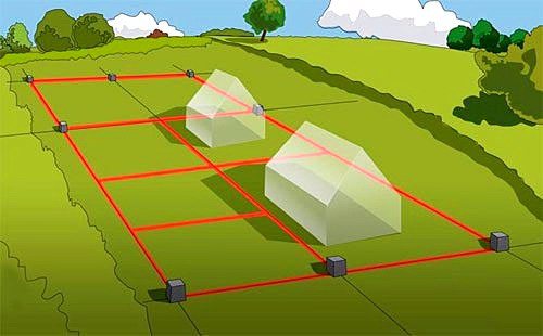
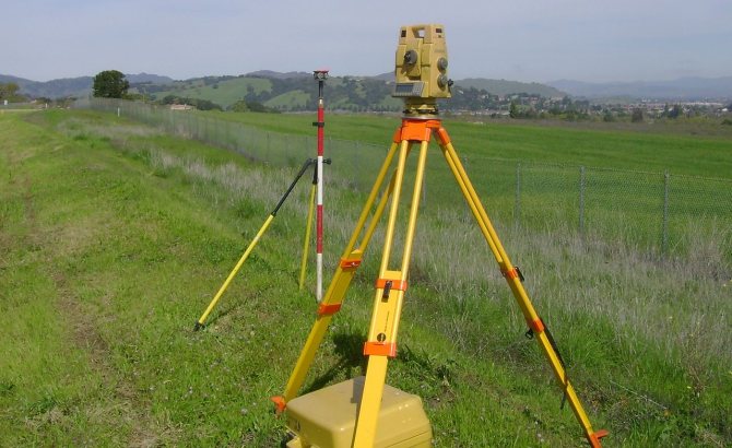
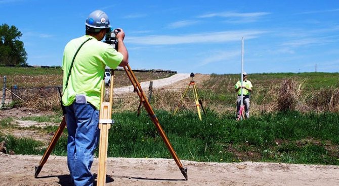
Carrying out land surveying
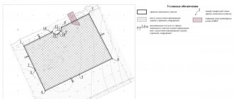
For further registration actions, a boundary plan of land plots formed upon the division of the common allotment is required (there is a mandatory requirement by law to carry out land surveying in case of changes in the original boundaries of land ownership).
An organization that has a license to carry out this type of activity should be engaged in establishing new boundaries of the resulting land plots. Otherwise, the issued documents will not have legal force. Engineering work to measure the area of plots, mark their boundaries and prepare accompanying documentation is included in the list of standard land surveying procedures, which must be carried out by a qualified specialist in the presence of all interested parties (co-owners of the plot).
The surveying procedure consists of:
- carrying out initial preparatory activities;
- order by the owners of a new technical project;
- notifying all interested parties about the land surveying procedure;
- establishing the boundaries of the obtained areas on the ground, their coordination and securing with boundary signs;
- measuring the area of plots, determining their coordinates and drawing up a new land management plan;
- preparation of documentation for submission to registration authorities.
A correctly completed land survey allows the owner of the plot to obtain its cadastral number and register it with Rosreestr.
Address assignment
If you wish, you can immediately after the land surveying procedure submit documents to the district administration or the territorial department of the MFC to assign new addresses to the resulting plots, while abolishing the old one (when constructing a residential building, the postal address of the building will automatically be assigned to the plot).
The petition must be accompanied by copies of the owner’s passport, an extract from the register, documents for land plots, as well as a copy of the agreement on division signed by all shareholders. Within three weeks from the date of receipt of the application, territorial authorities must transfer new addresses to the owners of the plots.
Registration of new plots for cadastral registration and registration in Rosreestr
A cadastral number is assigned to land holdings at the departments of state registration of real estate at their location. You can register a plot during a personal visit to the cadastral chamber, or by sending all the required documents by registered mail (including an inventory of what is being sent).
To obtain a cadastral number, you will need the following:
- application for the formation of a new land tenure and its registration in the cadastral register;
- receipt of payment of the state fee for carrying out this procedure;
- boundary map with confirmation of approval of established boundaries in the legally prescribed manner;
- title documents (certificate of ownership of land before its division, as well as deregistration upon change of integrity).
To register a plot, the cadastral chamber will need about three weeks from the moment its employees receive the documents. As a result of registration of plots, the owners will receive their passports, indicating that the objects have been assigned new cadastral numbers.
The final stage of the division is the entry of information about the formed land plots into Rosreestr with subsequent confirmation of the ownership rights of the owners.
To do this you will need to submit:
- statements from plot owners;
- receipts for payment of state duty for property registration;
- cadastral passports of formed land plots;
- evidence of ownership of the plot that was divided;
- notarized powers of the representative, if the registration procedure is carried out by the owner’s authorized representative.
Documents are submitted to the registration authority at the location of land ownership. Within a month, the owner of the plot will receive a new certificate of ownership (unless there are reasons for refusal or suspension of the procedure).
The process of dividing a plot of land into two or several smaller plots requires quite a long time and also involves the investment of considerable funds. However, in some cases, owning several small plots is more convenient than one large one, because after all the established measures have been carried out, the owner has the full right to dispose of these real estate objects at his own discretion.
Recognition of ownership rights to unauthorized construction
Correcting errors in cadastral information
How to carry out the consolidation of land plots in accordance with the Land Code
Documents for privatization of a municipal apartment
Dacha amnesty: what is it, simplification or new difficulties in registration?
How to sell an inherited apartment before the end of 3 years of ownership
How to divide a plot of land - procedure
To divide the land, it is necessary to follow the procedure established by law. In case of non-compliance, the division procedure may not be carried out in principle, or individual violations of the rights of participants in such a division may occur. From the point of view of legislation, the division of a land plot is carried out step by step as follows:
An agreement is concluded between the owners of the plot on the procedure for dividing such a plot. Moreover, if the division is carried out by one owner, such an agreement is not required. The drawn up agreement may imply granting individual participants in the division the right of ownership of specific newly formed plots, division of the owners’ shares in them and other individual nuances.- Based on the concluded agreement, with the involvement of the relevant cadastral engineers, the procedure for surveying the newly identified areas is carried out. In this case, land surveying must be carried out upon notification of all interested parties - these include both the owners of the newly designated plots and the owners of territories adjacent to them - neighbors. Without notifying neighbors and their consent, the land surveying procedure may subsequently be challenged in court and declared illegal.
- When land surveying is completed, an appeal should be sent to local authorities in order to assign addresses to the newly formed areas. In this case, one of them can be assigned the address of the area being destroyed.
- After the decision to assign addresses, you should submit an application to Rosreestr to divide the plot and assign cadastral numbers to new plots, as well as register ownership of them in accordance with the concluded agreement. All these procedures are carried out simultaneously.
When contacting Rosreestr, it is necessary to prepare a certain package of documents, without which the division of the plot will not be formalized properly. Thus, such documents include:
The applicant’s passport or passport, or other identifying documents, if one of the owners is a legal entity;- Application signed by all owners of the land plot;
- The decision of the authorities on assigning addresses to newly formed areas;
- Agreement on division of the plot between the owners;
- Title documentation confirming ownership of the divided plot;
- Boundary plan;
- A receipt for payment of the state duty, which ranges from 350 to 2000 rubles, depending on the intended purpose of the new plots.
After this, the fact of division of the site will be registered and all necessary documents will be drawn up that can confirm the emergence of ownership of the new lands.
Sequence of division of areas
Violation of the procedure for land surveying is a reason for declaring actions illegal. Consequently, the partition carried out will be considered invalid. At critical stages of dividing a plot, it is better to adhere to certain rules, and if there are difficulties, involve a specialized specialist.
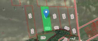
Before dividing land, experts usually create a plan visualizing the area and its planned division. This plan also shows existing real estate (houses, cottages, garages, outbuildings).
Next, to divide the land, owners need to go through the following steps:
- Conclude an agreement on the procedure for dividing the land . This is necessary if the plot has more than 1 owner. If you are going to carry out the division yourself, and you do not need outside permissions, for example, you want to allocate a plot of land for farming to your relatives and share the territory, then this is much easier to do;
- Invite engineers to carry out land surveying . During the separation process, all interested parties are notified. This also applies to neighbors who live near the site;
- Submit documents to government agencies . After all procedures have been completed, documents for the land + application are transferred or sent to the administration. In it, the applicant asks to assign numbers and addresses to the new sections. At the same time, in one of the objects he can assign to himself the characteristics of the common site, but on the condition that changes are made to the documents regarding the area and other characteristics of the object;
- Simultaneously with the submission of applications, the registration of ownership of the new owners of land plots is carried out.
This is the schematic sequence of legitimizing the division of a land plot.
The best places to build a house along Kashirskoye Highway
Why do people make floors out of cork and leather?
How to understand that this is luxury real estate?
How to grow bell peppers in your garden?
Cottage communities 2020. What has been built and will be completed this year?
Looking for a beautiful cottage. Villages in the Moscow region with the most picturesque architecture
Garden shower (for the garden). What types are there and how to choose?
Should you install sliding doors in your country house?
What should you consider when choosing a housekeeper (maid)?